Title 1 | home
Title 6
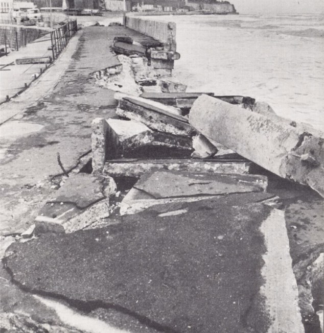
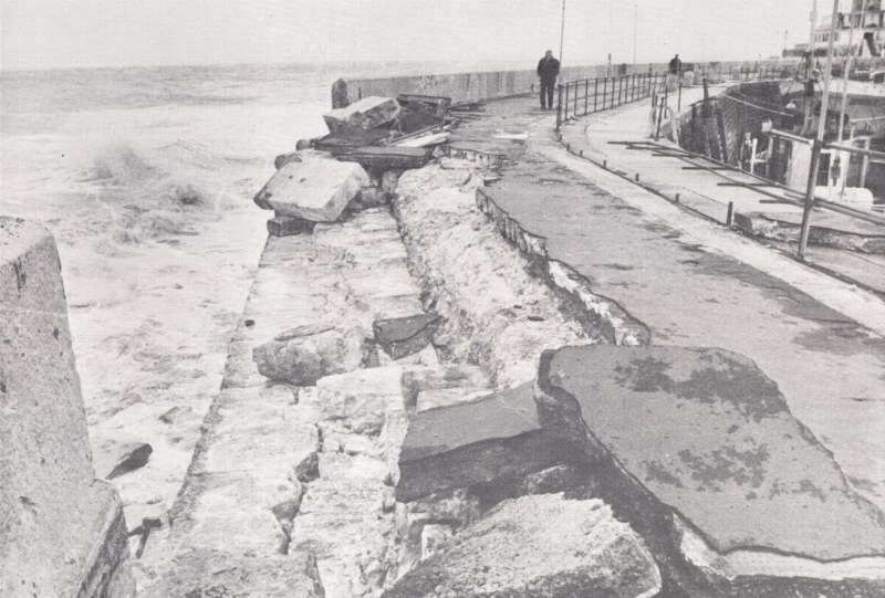
The pictures are of the last fairly significant failure of the eastern harbour wall about 1978 I think.
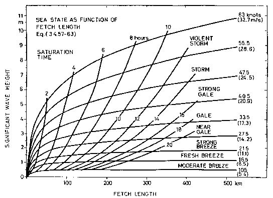
This would have been caused by a storm about force 9 to 10 easterly I would think. About 60 knots the maximum fetch (length of open sea the wind is blowing across) at Ramsgate is about 200km so you can see from the graph the wave height in the sea outside the harbour here would be about 7 to 9m. time is just how long the wind blows for.
My guess is the wave height in the harbour would be about 3 to 4 metres, under these conditions, dissipating where the depth of the water is less than the wave height to about the wave height. This would be a particular problem for the development due the depth of water under the bit that sticks out the furthest.